"AdrenaLina" ice fall
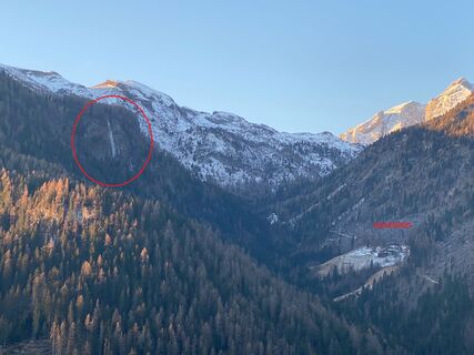
The "Davedino" "AdrenaLina" icefall is recognisable to the naked eye on the road from "Arabba" to "Pieve di Livinallongo del Col di Lana".
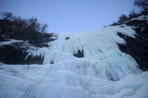
A beautiful and imposing waterfall, little frequented, in a unique...
The "Davedino" "AdrenaLina" icefall is recognisable to the naked eye on the road from "Arabba" to "Pieve di Livinallongo del Col di Lana".
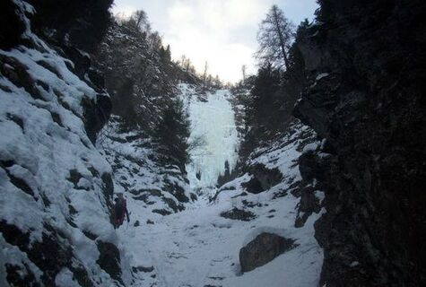
A beautiful and imposing waterfall, little frequented, in a unique environment of the "Fodom" Valley.
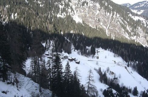
The enchantment of past times seems to have been preserved intact, with the small village of "Davedino" (1550 m, hamlet of "Livinallongo del Col di Lana") always in view as you climb.

Coming from "Belluno", reach the village of "Saviner di Laste", immediately after "Caprile". Follow the SS 563 road to "Digonera" and from here continue in the direction of "Livinallongo del Col di Lana". After the village of "Digonera", cross a bridge and at the third hairpin bend, you will find a small road on the left with directions to "Davedino".
The kit for ice climbing: boots in the right size, snug-fitting, hard-soled and adjustable knee-high gaiters crampons (articulated, semi-rigid or rigid, or just front points) helmet ice axe ice pitons rope Abalakov hooks
WARNING: This list is for information purposes only and does not claim to fully explain the correct functioning of the various tools mentioned, so please refer to the respective user manuals. Our advice is to be taken only as part of a process of training and practice to be undertaken with qualified instructors in order to control these belay techniques. This list is not intended to be exhaustive, nor is it a substitute for specific sport climbing belay training, for which you should check your skills with qualified instructors.
If you are approaching this practice for the first time, it is reccomended to contact the Alpine Guides.
Always let someone know where you are going and the approximate duration of the hike and avoid going alone.
The telephone number in case of emergency is 112 or 118 (ambulance).
From Innsbruck A22 Brennero highway to the Bressanone tool booth, continue through the Pusteria Valley, Badia Valley and the Campolongo Pass From Verona/Milan A22 Brennero highway up to Egna Ora tool booth, continue for Fiemme Valley, Fassa Valley, Pordoi Pass and Arabba From Venice A27 highwayway tool booth Belluno follow the Agordina 203 to Agordo and Caprile.
By train
Nearest railway stations
Belluno - 70 km Brunico - 48 km Ponte Gardena - 51 km
By bus
Brunico - 47 Km connection by SAD line www.sad.it Belluno - 70 km - connected by the Dolomitibus www.dolomitibus.it
By plane
Venice Treviso/Venice Marco Polo - 160/170 km Innsbruck - 140 km Verona - 270 km Milan Bergamo/Milan Malpensa - 310/400 km
Small parking area near the village of "Davedino".
Mounitain guides:
- Francesco Tremolada https://www.proguide.it/
- Filippo Beccari https://www.arabba.it/it/arabba/filippo-beccari-guida-alpina/20-72173.html
Before the start, it is reccomended to get informed about the weather, which changes rapidly in the mountains, and the conditions of the route.
Webcams de la tournée
Parcours populaires à proximité
Ne manquez pas les offres et l'inspiration pour vos prochaines vacances
Votre adresse électronique a été ajouté à la liste de diffusion.


