


Kuruzzen hiking trail


This varied circular hike leads through the historic border region of the federal states of Styria and Burgenland. It offers not only magnificent views but also fascinating insights into the region's eventful...
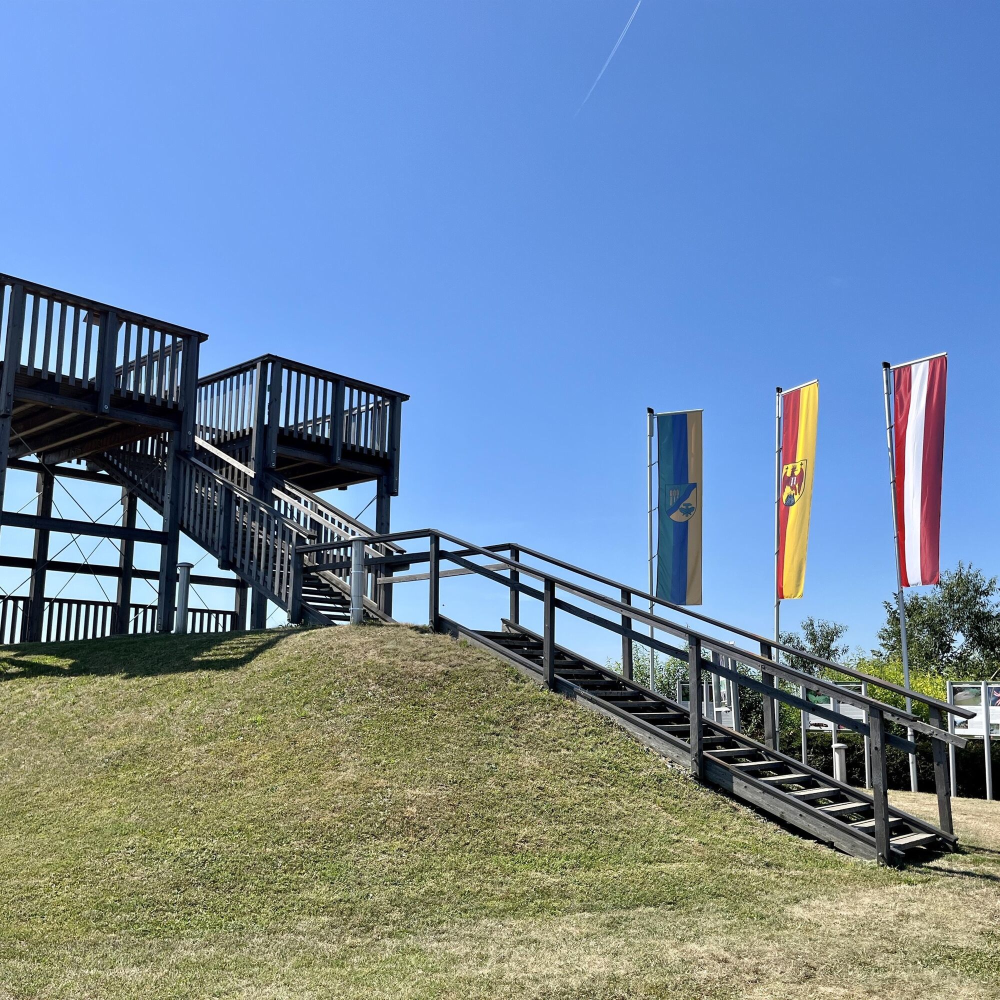
This varied circular hike leads through the historic border region of the federal states of Styria and Burgenland. It offers not only magnificent views but also fascinating insights into the region's eventful past. Even in the center of Burgau, an original brochure stand draws attention to the extensive hiking and recreational opportunities available. A detour to Burgau Castle, first documented in 1367 and now the municipality's landmark, is definitely worthwhile. Along the trail, numerous information panels tell of the region's development over the past centuries. Hikers will encounter historical terms such as Hoadnsterz, Türkentommerl, Tschartake, Kuruzzen, Kruzitürken, and the "Pfeffer-Paprika-Linie" (pepper-paprika line) – names that refer to the eventful history of this border region. The Burgauberg lookout tower is an ideal rest stop with a magnificent panoramic view. From here, the view extends far over the hilly landscape, and panoramic panels make orientation easier. Another highlight awaits hikers near the Lafnitz River: a faithfully reconstructed Tschartake, an old border guard tower that can be climbed. A hike that brings history and landscape to life – ideal for anyone who wants to combine nature and cultural heritage.

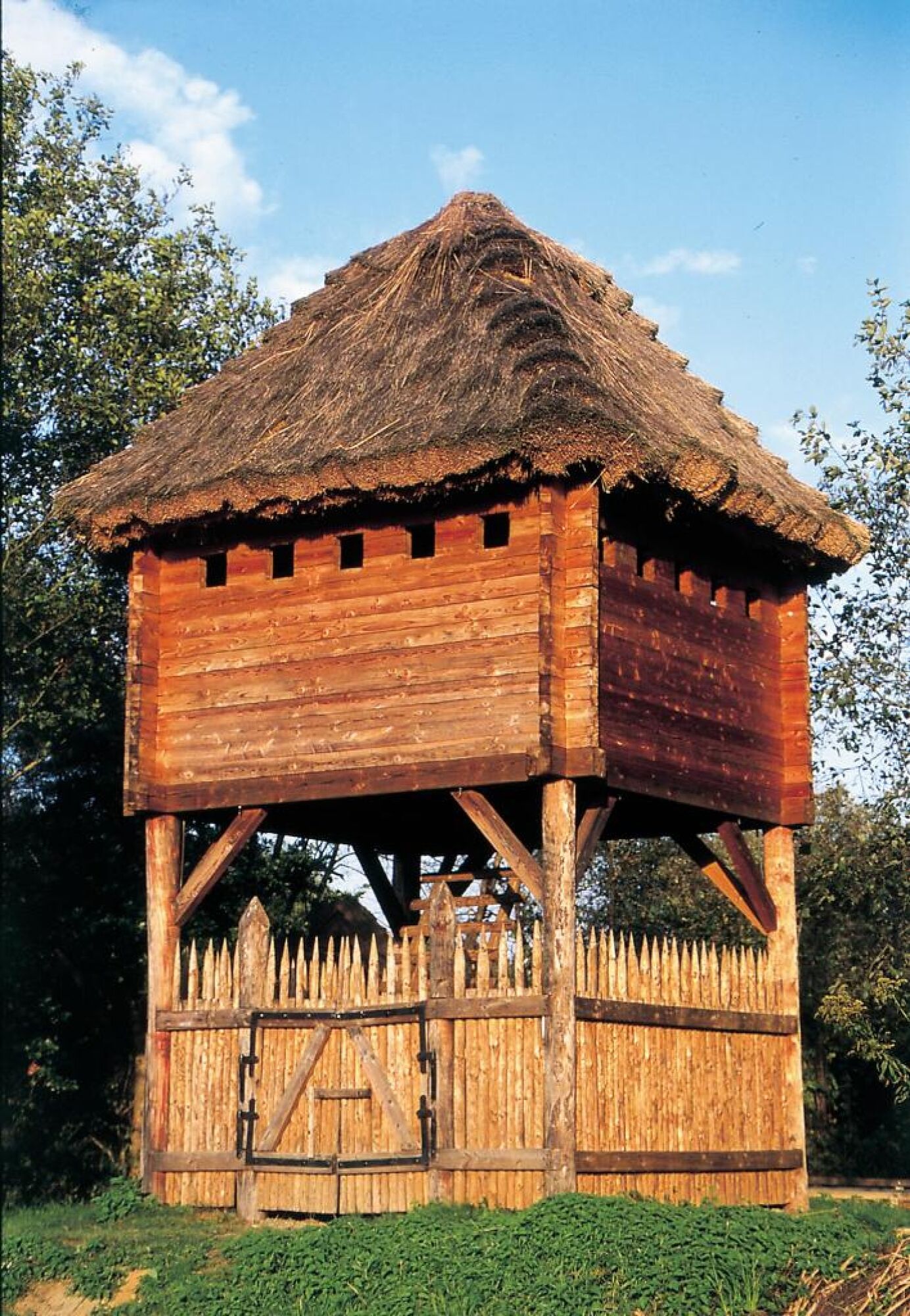
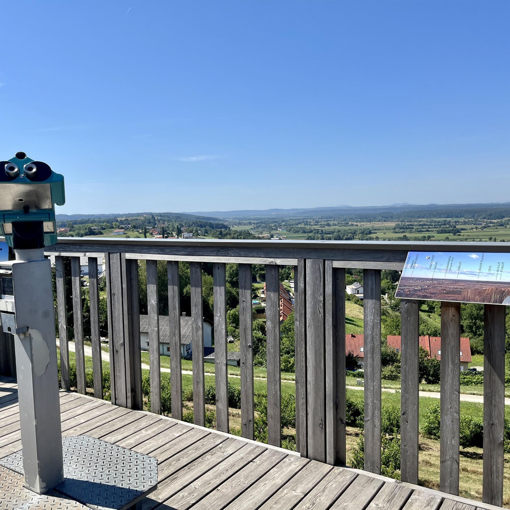
The hike starts right next to the Burgauberg lookout tower, a magnificent vantage point with panoramic views over the Lafnitz Valley. From here, the trail leads south, slightly downhill, and continues through open terrain past farms and fields. You soon reach the edge of the forest, follow the path westward, and reach the edge of a meadow. There, turn left and hike toward the Lafnitz Valley. You then reach the Lafnitz river basin, which forms the border between Styria and Burgenland. The trail continues along the natural riverbank to the faithfully reconstructed Tschartake – an old border guard tower that can now be climbed and offers fascinating insight into the region's history. After this historical break, the circular trail continues west before branching off again to the south. You continue along old field boundaries until you reach gently rolling terrain again.
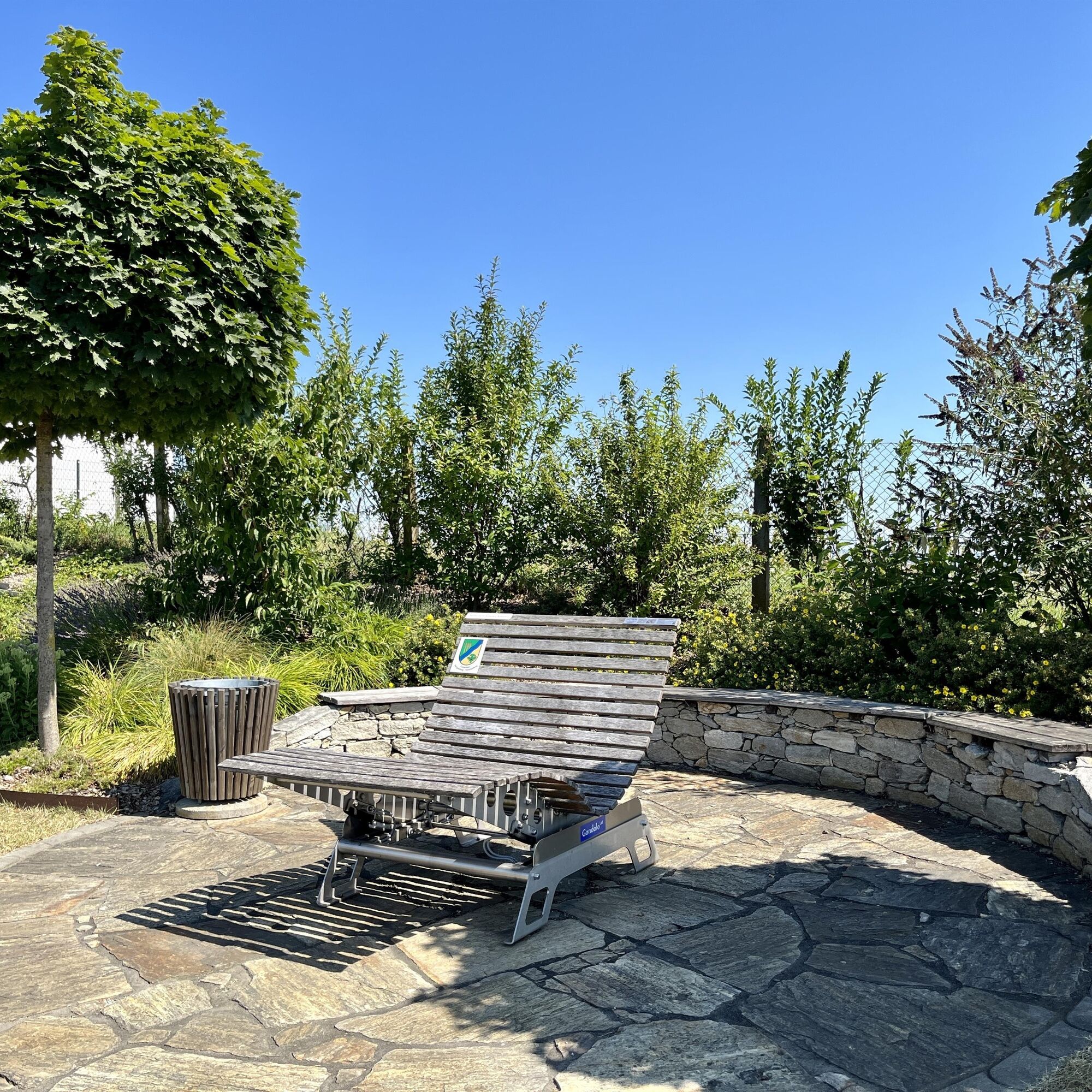
Then the trail heads north again, past orchards and small farmsteads, before returning to the starting point. Shortly afterward, the trail climbs again toward Burgauberg. The final sections bring hikers back to the starting point at the Burgauberg lookout tower, where the loop concludes after about 8 kilometers. It's worth ending the hike here with a final view from the observation tower—or with a comfortable bench and a view of the border region, which so impressively combines history and landscape.
Oui
Sturdy footwear, weather-appropriate clothing, and plenty of drinking water are recommended. History buffs will also appreciate binoculars—the view from the tartake and the observation tower is impressive.
Sturdy footwear is recommended, as some sections of the trail are unpaved and can be slippery when wet. Surefootedness is required in the Lafnitz area – please exercise particular caution when climbing the Tschartake.
Take the B57 from Güssing or Oberwart to Stegersbach. From Stegersbach, take the Grazer Straße (57a) towards Burgauberg.
Free parking at the Burgauberg municipal office
From the Tschartake, you have a magnificent view over the Lafnitz Valley – here, the history of this border region is particularly vivid. In the center of Burgau, it's worth taking a detour to Burgau Castle or enjoying a cozy stop at one of the two inns. Finally, for refreshments, stop at the Buschenschank (wine tavern) not far from the end point.
Parcours populaires à proximité
- 3,6
Keltischer Baumkreisweg
moyenRandonnée12,8 km - 3,6
Fantastische Tour in Bad Blumau
moyenFaire du vélo37,7 km - 2,9
Southern Burgenland Paradise Route
difficilePiste cyclable longue distance261,6 km - 4,5
Thermen Rundwanderweg in Bad Waltersdorf
moyenRandonnée17,5 km - 4,9
Nat(o)ur in Bad Blumau
facileRandonnée6,45 km - 5,0
Burgau: Waldtour
Faire du vélo25,0 km - 5,0
Auffen: Hofwald-Weg
moyenRandonnée9,50 km - 5,0
W6 Keltischer-Baumkreis-Weg - Bad Waltersdorf
moyenChemin thématique12,7 km - 4,0
W2 Blumenwanderweg - Bad Waltersdorf
facileChemin thématique7,39 km - 4,6
R33 Harter Teichradweg
Faire du vélo25,1 km
Randonnée et suivi


Ne manquez pas les offres et l'inspiration pour vos prochaines vacances
Votre adresse électronique a été ajouté à la liste de diffusion.